The main stages in the formation of the political map of the world. The elimination of colonialism, the creation and development of independent states The second name of the colonial stage
The process of decolonization, i.e. the elimination of colonial rule and the granting of political independence to the peoples, stretched out over several decades and had three stages that differed in content from each other.
The first of them covered 1945-1955. It opened with the August revolutions of 1945 in Vietnam and Indonesia. Taking advantage of the defeat in the war of Japan, which occupied these countries, the left forces, which fought in an organized manner against the Japanese, declared independence. Their former mother countries - France and Holland, having restored their own statehood after the German occupation, tried to regain dominance over these countries, but were defeated in a long-term bloody war. Having declared independence in October 1945, Laos was again occupied by France and received freedom only in 1953 together with Cambodia.
The British acted differently with their colonies in Asia, demanding independence. The Labor government met them halfway, transferring full power into the hands of the national forces, already prepared for this. In 1947, independent governments were established in India and Pakistan; in 1948, in Burma, Israel, and Sri Lanka. In total, in the first post-war decade, 11 states in Asia and one in Africa (Libya) gained independence.
The second stage (mid-50s - late 60s) was more organized and even somewhat systematic in granting independence to the colonies. Having come to terms with the inevitability of the loss of colonies, European countries, primarily England, took care of additional training of managers, military personnel, teachers, doctors, etc., in order to prevent chaos in the new states and to maintain their influence in them. The principles and order of management, the mechanism for the transfer of power were developed. To this end, the colonialists often made contact with the national liberation movements. During this period, 7 countries in Asia and 37 in Africa gained independence. The decisive year was 1960, when 17 African countries at once became independent. It went down in history as "the year of Africa. Only in the case of Algeria did France use every force and means to prevent independence. For 8 years - from 1954 to 1962 - she waged a colonial war, which was associated with the great integration of the two economies and with the
Algeria has huge oil fields. Only in 1962 did Algeria become independent, which was facilitated by the support of the world community and the UN, which back in 1960 adopted the “Declaration on the Granting of Independence to Colonial Countries and Peoples”
At the third stage, which began in the first half of the 1970s, the remnants of the once mighty colonial empires were liquidated. In 1975, the last of them, the Portuguese, fell, giving independence to Angola, Mozambique, Sao Tome and Principe. Until the mid-1990s, 11 countries in Africa acquired their state status. It is noteworthy that most African countries have maintained close ties with their mother countries. Many of them are respectively part of the British and French Commonwealth of Nations.
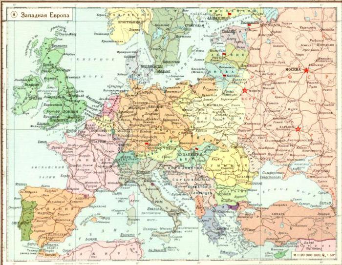
The modern political map is largely a reflection of the thousand-year history of human civilization.
In the ancient period, such countries as Egypt, Babylonia, Greece, India, China, and later the Roman Empire played a decisive role in the development of human civilization. Within the boundaries of modern Ukraine in this period was the Bosporan kingdom, the Scythian state.
The decline and collapse of the Roman and Parthian empires (5th-7th centuries) begin the medieval period of formation political map peace.
The era of the great geographical discoveries, the emergence of the first democracies (XV-XVI centuries) marks the beginning of a new period in the formation of the political map.
Especially great changes took place in the XIX-beginning of the XX century. In total, there were 55 sovereign countries on the globe in 1900. Completion of the complete


division of the world at the beginning of the 20th century. also marked the end of a new period in the formation of the political map.
The defining events of the first stage (1914-1939) of the newest period were the emergence of a whole group of independent countries, as well as the split of the world into two systems according to an ideological principle. So, on the political map of Europe appeared such states as Poland, Czechoslovakia, Hungary, Finland, Lithuania, for a short time the Ukrainian People's Republic, etc. In total, in 1939 there were 71 sovereigns per country. The split of the world consisted in the fact that after the end of the First World War, a huge state was formed with a totalitarian regime and a command-administrative type of economy - the USSR.
The end of the Second World War (1939-1945) The countdown of the second stage of a new period in the formation of the political map of the world began. As a result of the war alone, which led to significant territorial changes, in 1947 the number of states increased by 10 in comparison with the pre-war period.
A characteristic feature of the second stage was the creation of socialist countries in Europe and Asia. Economic rivalry began between the two systems, an ideological and political struggle for spheres of influence flared up, which went down in history under the name " cold war".
The defining feature of the second stage of the new period of formation of the political map of the world was that dozens of countries in Africa, Asia, the Caribbean in the 1950s-1960s. They proclaimed independence, freeing themselves from colonial oppression. In the early 1960s The huge colonial system practically ceased to exist. In 1962 there were already 127 states in the world.
In the early 1990s the third stage of the newest period of formation of the political map of the world began. It was marked by the end of the Cold War, the unification of Germany into a single state. Its most important result was the emergence of almost 20 new nation-states.
Typology of countries
If the classification of countries, like any other geographical objects, is carried out mainly according to one quantitative attribute, then the typology involves their grouping according to several stable qualitative characteristics. These can be considered the type of economic system, the level of socio-economic development, the political regime, etc.
Since the early 1990s Significant transformations have taken place in the former socialist countries, and therefore most of them (with the exception of Cuba and North Korea) could be called post-socialist. There are 33 of all sovereign post-socialist and socialist countries today. Taking into account the differences in the emergence and organization of state power, they are divided into two subtypes: post-socialist and socialist (18) and post-Soviet (15).
The first group includes Poland, Czech Republic, Slovakia, Hungary, Slovenia, Romania, Bulgaria, Macedonia, Albania, Croatia, Bosnia and Herzegovina, Serbia, Montenegro, Mongolia, China, North Korea, Vietnam, Cuba.
The second subtype includes countries that emerged during the collapse of the USSR: Russia, Estonia, Latvia, Lithuania, Ukraine, Belarus, Moldova, Georgia, Armenia, Azerbaijan, Kazakhstan, Turkmenistan, Uzbekistan, Kyrgyzstan, Tajikistan.
Modern typologies propose to divide countries into two main types: economically developed countries and developing countries.
52 countries belong to economically developed countries. First of all, these are highly developed states with a market economy (24 in Europe - Iceland, Norway, Sweden, Finland, Denmark, Ireland,

UK, Belgium, Netherlands, Luxembourg, Germany, France, Monaco, Switzerland, Liechtenstein, Austria, Andorra, Spain, Portugal, Italy, San Marino, Vatican City, Malta, Greece; two in Asia - Israel, Japan; two in America - USA and Canada; one in Africa - South Africa; Australia and New Zealand).
A special role among the market countries is played by the G7 countries (USA, Japan, Germany, Great Britain, France, Italy and Canada), which account for the majority of world production, and political events in the world also largely depend on them.
Countries such as Israel, Canada, South Africa, Australia and New Zealand are called countries of "settlement capital".
Developing countries include 142 other states, of which three are post-socialist in Europe (Albania, Bosnia and Herzegovina, Moldova), in Asia - 42, Africa - 52, Latin America - 33, Oceania - 12. There are also significant differences between them in socio-economic development.
Among the developing countries, a group of new industrial countries stands out especially - "Asian tigers * (South Korea, Taiwan, Singapore, as well as a city with a special status in China - Hong Kong) and Latin American countries (Argentina, Brazil, Mexico, Chile, Venezuela, Uruguay Oil exporting countries - Saudi Arabia, Kuwait, UAE, etc. - are marked with high incomes.
Among other typologies, the division according to the degree of development of society is interesting. Countries are divided into pre-industrial, industrial and post-industrial.
The first group consists of developing ones, but they are still dominated by pre-industrial elements of production. The second group includes countries with a well-developed heavy industry (the post-socialist countries of Europe and the newly industrialized countries). Post-industrial days are the majority of states with a developed market economy, where a significant part of the economically active population is employed in the service sector, and computerization has penetrated into all spheres of society.
It can be considered in two aspects. The first is a simple publication on paper, which reflects how the world works in terms of the alignment of political forces. The second aspect considers this concept from a broader perspective, as about the formation of states, their structure and split, about the reshuffle of forces in the political world, about the advantage and influence of large and powerful states on the world economy. The past gives us a picture of the future, which is why it is so important to know the stages in the formation of the political map of the world.
general information
Any state has its own life cycle. It is a curve that looks like a hump. At the beginning of its journey, the country is being built and developed. Then comes the peak of development, when everyone is happy and everything seems to be fine. But sooner or later, the state loses its strength and power and begins to gradually fall apart. So it has always been, is and will be. That is why over the centuries we have seen the gradual rise and fall of great empires, superpowers and huge colonial monopolies. Consider the main stages in the formation of the political map of the world. The table is shown in the figure:
As you can see, many historians distinguish exactly five stages modern history. In various sources, you can find only 4 main ones. Such a dilemma arose a long time ago, since it is possible to interpret the stages of the formation of the political map of the world in different ways. The table of main sections proposed by us contains the most reliable information to date.
ancient period
IN ancient world the first great states enter the arena of major events. You all probably remember them from history. This is the glorious Ancient Egypt, powerful Greece and the invincible Roman Empire. At the same time, there were less significant, but also quite developed states in the Middle and East Asia. Their historical period ends in the 5th century AD. It is generally accepted that it was at this time that the slave-owning system became a thing of the past.

medieval period
In our minds, during the period from 5 to 15 centuries, there have been a lot of changes that cannot be covered in one sentence. If the historians of that time knew what the political map of the world was, the stages of its formation would have already been divided into separate parts. After all, remember, during this time Christianity was born, Kievan Rus was born and disintegrated, it begins to emerge. In Europe, large feudal states are gaining strength. First of all, these are Spain and Portugal, which vied with one another to make new geographical discoveries.

At the same time, the political map of the world is constantly changing. The stages of formation of that time will change the future fate of many states. The mighty Ottoman Empire will exist for several more centuries, which will capture the states of Europe, Asia and Africa.

new period
From the end of the 15th to the beginning of the 16th centuries, a new page began on the political arena. It was the time of the beginning of the first capitalist relations. Ages when huge conquerors of the whole world begin to emerge in the world. The political map of the world is often changed and remade. Stages of formation constantly replace each other.
Gradually Spain and Portugal lose their power. Due to the robbery of other countries, it is no longer possible to survive, because more developed countries are moving to a completely new level of production - manufacturing. This gave impetus to the development of such powers as England, France, the Netherlands, Germany. After the American Civil War, they are joined by a new and very large player - the United States of America.
The political map of the world changed especially often at the turn of the 19th and 20th centuries. The stages of formation in that period depended on the outcome of successful military campaigns. So, if back in 1876 European countries captured only 10% of the territory of Africa, then in just 30 years they managed to conquer 90% of the entire territory of the hot continent. The whole world entered the new 20th century already practically divided between the superpowers. They controlled the economy and ruled alone. Further redistribution was inevitable without a war. Thus ends a new period and begins newest stage formation of the political map of the world.

The newest stage
The redistribution of the world after the First World War made huge adjustments in First of all, four powerful empires disappeared. These are Great Britain, the Ottoman Empire, the Russian Empire and Germany. In their place, many new states were formed.
At the same time, a new trend appeared - socialism. And a huge state appears on the world map - the Union of Soviet Socialist Republics. At the same time, such powers as France, Great Britain, Belgium and Japan are becoming stronger. Some of the lands of the former colonies were transferred to them. But such a redistribution does not suit many, and the world is again on the verge of war.
At this stage, some historians continue to write about the newest period, but it is now generally accepted that with the end of World War II, the modern stage of the formation of the political map of the world begins.

Modern stage
Second World War outlined to us those boundaries, most of which we see today. First of all, this concerns the states of Europe. The greatest result of the war was that the colonial empires completely disintegrated and disappeared. New independent states emerged in South America, Oceania, Africa, and Asia.
But the largest country in the world, the USSR, still continues to exist. With its collapse in 1991, another important stage appears. Many historians distinguish it as a subsection of the modern period. Indeed, in Eurasia after 1991, 17 new independent states were formed. Many of them decided to continue their existence within the borders Russian Federation. For example, Chechnya defended its interests for a long time, until the power of a powerful country won as a result of hostilities.
At the same time, changes continue in the Middle East. There is a unification of some Arab states. In Europe, a united Germany is emerging and the Union of the FRY is disintegrating, resulting in the emergence of Bosnia and Herzegovina, Macedonia, Croatia, Serbia and Montenegro.

Continuation of a story
We have presented only the main stages in the formation of the political map of the world. But the story doesn't end there. As events show recent years, you will soon have to allocate a new period or redraw the cards. After all, judge for yourself: two years ago, Crimea belonged to the territory of Ukraine, and now you need to completely redo all the atlases in order to change its citizenship. And also problematic Israel, drowning in battles, Egypt on the verge of war and the redistribution of power, incessant Syria, which mighty superpowers can wipe out from the face of the Earth. All this is our modern history.
The era, later called the era of the Great Geographical Discoveries, began at the end of the 15th century; in fact, it was a period of economic and political development of new lands by Europeans. Then the reconquest - the liberation of the Iberian Peninsula from the Arab conquest, could not stop, and grew into a conquest - the conquest of new lands.
In 1415, the Portuguese captured the first overseas territory - the city of Ceuta on the coast of modern Morocco (today - a city under the control of Spain), a rich port, the end point of the trans-Saharan trade route. Gold purchased by Arab merchants in exchange for fabrics and salt was brought to Ceuta. The riches of Ceuta stimulated the search for new treasures in West Africa.
There were two ways to get to them. The first lay across the Sahara, where heat, sands, lack of water, and warlike tribes of nomads lay in wait for the invaders. The second way - sea - was more preferable. This was facilitated by the success of the Portuguese in navigation, navigation, and shipbuilding.
By 1425, the Portuguese had reached Cape Green, the westernmost tip of Africa. In addition to purely economic goals, they were interested in searching for the proposed western tributary of the Nile, which was supposed to flow into the Atlantic Ocean. Another important reason for the expeditions was the search for the Christian king-priest John, who allegedly sent a letter to the Pope asking for help from an unknown eastern country.
Actually, the economic development and political domination of Europeans in Africa was preceded by exploration of the coasts and hinterlands of the mainland. At the end of the XV century. the Spaniards began sailing along the coast of West Africa, reaching the mouth of the Congo River, and then to the mouth of the Great Fish River in southern Africa. During these expeditions, astronomical research was carried out, observations of the weather, flora and fauna were made, the coast was mapped, and the life of the tribes of the coastal strip was studied.
In 1652, 90 Dutch landed in Table Bay and began building Cape Town as a stopping point on their way to India.
By the beginning of the XVII century. Africa was mostly discovered by Europeans. On the maps of that time, the outlines of the mainland already almost corresponded to modern ones, but the hinterland remained terra incognita (“unknown land”) for more than a century. The vague ideas of Europeans about Africa are evidenced by geographical maps, on which most of the continent is occupied by scenes of battles of one-eyed cyclops with people. This, however, did not prevent the development of an intensive slave trade.
Europeans did not find centralized states in Africa, as, for example, in Latin America. Before the arrival of Europeans, separate feudal states existed in Africa: in West Africa - Kano and Katsina, Mali, Songhai; in East Africa, Aksum; in the South-Eastern - Monomotapa. Some of them were fabulously wealthy and played a significant role in the world politics and economy of the Middle Ages. However, by the time the Europeans arrived, these states were experiencing a period of feudal fragmentation and could not resist the Europeans. Many of them fell apart due to civil strife even before the arrival of the colonialists.
Stages of formation of the political map of Africa. The modern political map of Africa was formed mainly under the influence of European colonization and decolonization.
In 1885, the spheres of influence in Africa were divided according to the decisions of the Berlin Conference. By the beginning of the XX century. 90% of the territory of the continent was in the possession of European powers. French colonies located mainly in Western and Central Africa (about 38% of the continent): Algeria, coastal regions of Somalia, Comoros, Madagascar, Western Sahara, Tunisia, French West Africa, French Congo. Eastern Sahara was also a sphere of French influence.
British colonies(about 30% of the continent's area) were located mainly in East Africa, Great Britain tried to control the entire space "from Cairo to Cape Town": Anglo-Egyptian Sudan, Basutoland, Bechuanaland, British East Africa, British Central Africa, Ascension Island, Gambia, Egypt, Zanzibar and Pemba, Gold Coast, Cape Colony, Libyan Desert, Mauritius, Natal, Nigeria, Rhodesia, St. Helena, Seychelles, British Somalia, Sierra Leone, Tristan da Cunha, Uganda.
Portugal, despite the fact that she was the first to start colonization, only Angola, the Azores, Portuguese Guinea, the Cape Verde Islands, Madeira, Sao Tome and Principe, Mozambique belonged.
Germany(before its defeat in the First World War) belonged to the territory of the modern states of Tanzania, Rwanda and Burundi, Togo, Ghana and Cameroon; Belgium- Zaire. Eritrea and part of Somalia were possessions Italy. Spain belonged to Spanish Guinea (Rio Muni), the Canary Islands, Presidios, Rio de Oro with Ifini.
In 1822, freed slaves from the United States were settled on the lands purchased by the American Colonization Society from local leaders, and in 1847 the Republic of Liberia was formed on this territory.
By the beginning of the 50s. 20th century there were only four legally independent states on the continent - Egypt, Ethiopia, Liberia, South Africa. Decay colonial system began in the north of the continent. In 1951, Libya became independent, in 1956 - Morocco, Tunisia and Sudan. In 1957-1958. Ghana and Guinea gained independence.
In 1960, which went down in history as the "Year of Africa", 17 colonies achieved independence. In the mid 70s. 20th century All Portuguese colonies gained independence.
Namibia gained independence in 1990.
In 1993, after 30 years of struggle for self-determination, a new sovereign state appeared on the map of Africa - Eritrea (formerly a province of Ethiopia).
Forms of government and government. At the beginning of the XXI century. There were about 60 states and territories in Africa. Most of them - unitary republics. Federal republics- Nigeria, South Africa, Federal Islamic Republic of the Comoros, Ethiopia.
Monarchies- Lesotho, Morocco, Swaziland.
Non-Self-Governing Territories- Reunion Island (French overseas department), Mayotte Island (territorial administrative unit of France), St. Helena (UK colony), Ceuta and Melilla (Spanish possessions), Western Sahara.
Independent member states of the Commonwealth- Botswana, Gambia, Ghana, Zambia, Zimbabwe (deleted in 2002), Kenya, Lesotho, Mauritius, Malawi, Mozambique (adopted in 1995), Namibia, Nigeria, Swaziland, Seychelles, Sierra Leone, Tanzania, Uganda, Cameroon, South Africa.
The main events of the XX century.
1902- As a result of the Anglo-Boer War (1899-1902), the former Boer republics of the Orange Free State and the South African Republic of the Transvaal became the British colonies of the Orange Republic and the Transvaal.
1904- the so-called "cordial agreement" between France and Great Britain was concluded: Great Britain recognized France's rights to Morocco, ceded to France part of the territory in the Gambia River region and the border areas between the British and French colonies in Eastern Nigeria.
1906- the division of Abyssinia (modern Ethiopia) into spheres of influence: the north-western and western parts went to Great Britain; Italy - the northern part and territories west of Addis Ababa; France - areas adjacent to French Somalia.
Consolidation of the British possessions of Lagos and Southern Nigeria into the colony of Southern Nigeria.
1907- The British protectorate of Nyasaland (since 1893 it was called British Central Africa) adopted its former name.
1908- The French possession of the Comoros is included in the colony of Madagascar.
The Belgian Parliament declared the Congo Free State a colony of the Belgian Congo. In 1885-1908. Kongo was considered the personal possession of King Leopold II, who ruled it alone.
1910- the formation of the Union of South Africa (SA) as part of the British possessions: the Cape Colony, the colonies of Natal, Transvaal and the Orange Republic. South Africa received the status of a dominion of the British Empire.
French Congo renamed French Equatorial Africa.
1911- France transferred to Germany part of French Equatorial Africa (275 thousand km 2) as compensation for the establishment of a French protectorate in Morocco.
1912- Morocco declared a protectorate of France. The Spanish protectorate zone consisted of two parts in the north and south of Morocco. A “special regime” has been established in the city of Tangier and in the adjacent territories.
On the property Ottoman Empire Tripolitania and Cyrenaica formed the colony of Italian Libya.
1914- An English protectorate was established over Egypt (occupied by Great Britain in 1882, but considered a province of the Ottoman Empire). The unification of the British possessions of Northern and Southern Nigeria into a single Colony and Protectorate of Nigeria.
Partition of the French Sudan colony, formation of the colony of Upper Volta as part of French West Africa.
Changes on the political map of Africa after the First World War associated with the loss of Germany's colonies and their transfer under the mandate of the League of Nations to the victorious powers. Great Britain transferred part of German East Africa - Tanganyika. Togoland and Cameroon (West Africa) were divided between France (Togo and East Cameroon) and Britain (Ghana and West Cameroon). South Africa was transferred to German South-West Africa (Namibia), Belgium - part of German East Africa (the territory of Ruanda-Urundi), Portugal - the "Kionga Triangle" (part of German East Africa in the Ruvuma River near the borders of Mozambique).
1920- part of British East Africa became known as the Colony and Protectorate of Kenya.
1921- formation of the Rif Republic (northern part of Spanish Morocco); defeated in 1926 by the combined forces of Spain and France.
1922- the abolition of the British protectorate over Egypt, the declaration of Egypt as an independent kingdom.
Formation of the Niger colony in French West Africa. The British possession of Ascension Island is included in the colony of St. Helena.
1923- The city of Tangier and its surrounding areas are declared an international zone.
1924- the transfer by Great Britain of part of Kenya (Jubaland) under the control of Italy.
The actual liquidation of the condominium (joint management) over the Anglo-Egyptian Sudan, the establishment of the exclusive authority of Great Britain.
1932- Accession of the French colony of Upper Volta to the colony of the Ivory Coast.
Changes on the political map of Africa after the Second World War
1935- Italian capture of Ethiopia. The unification of Eritrea, Italian Somalia and captured Ethiopia into the colony of Italian East Africa.
1941- the liberation by the troops of the allies of Ethiopia and the return of her independence.
1945- French Sudan received the status of an overseas territory of France.
1946- The French government passed a law granting the status of overseas departments to the colonies, including Reunion, French Somalia.
The status of trust territories was given to the former mandated territories (colonies of Germany transferred after the First World War to the victorious powers).
The Comoros, previously administratively united with Madagascar, became an independent administrative unit (colony of France).
1949- South West Africa (Namibia) is included in the territory of the Union of South Africa.
1950- transfer of Somalia (formerly a UN Trust Territory) under the control of Italy for a period of 10 years.
1951- Declaration of Independence of the Kingdom of Libya.
Guinea-Bissau, Cape Verde, Mozambique, Sao Tome and Principe have been granted the status of overseas provinces of Portugal.
1952- the overthrow of the monarchy in Egypt (in 1953 a republic was proclaimed).
The UN decision on the accession of the former Italian colony of Eritrea to Ethiopia as an autonomous state. Establishment of the Federation of Ethiopia and Eritrea.
1953- the formation of the Federation of Rhodesia and Nyasaland from three British possessions - Northern Rhodesia, Southern Rhodesia and Nyasaland (dissolved in 1964). The Federation became part of the Commonwealth.
1956- the independence of the Republic of Sudan (formerly an Anglo-Egyptian possession, then a colony of Great Britain) and the French zone in Morocco was proclaimed, the formation of the Kingdom of Morocco. The Spanish-Moroccan declaration was signed on the independence of Spanish Morocco and its accession to the Kingdom of Morocco.
The abolition of the French protectorate over Tunisia, the formation of the Kingdom of Tunisia (since 1957 - a republic).
Declaration of French Togo as an autonomous republic within the French Union.
1957- the independence of the British colony of the Gold Coast was proclaimed, the state of Ghana was formed (since 1960 - a republic).
The international zone of Tangier became part of Morocco.
1958- Ifni and Spanish Sahara (formerly part of Spanish West Africa) received the status of Spanish provinces and declared a part of Spain (now Ifni is an administrative district in Morocco).
Creation of the United Arab Republic, including Egypt and Syria (Syria withdrew from the UAR in 1961).
French Guinea granted independence, Republic of Guinea formed.
The status of the member republics of the French Union was given to: Ivory Coast, Upper Volta, Dahomey, Mauritania, Niger, Senegal, French Sudan (formerly part of the Middle Congo, Equatorial Africa), Gabon, Middle Congo, Ubangi-Shari, Chad (formerly - French Equatorial Africa), Madagascar. The middle Congo was renamed the Republic of the Congo, Ubangi-Shari - Central Africa, French Somalia received the status of an overseas territory.
1959- Equatorial Guinea became an overseas province of Spain.
1960- the former French colonies gained independence and were proclaimed republics: Togo (formerly a UN Trust Territory under France), the Federation of Mali as part of Senegal and French Sudan, the Malagasy Republic (Republic of Madagascar), Dahomey (Benin), Niger, Upper Volta (Burkina- Faso), Ivory Coast (Ivory Coast), Chad, Central Africa (CAR), Republic of the Congo, Mauritania, Gabon, Republic of Somalia (former British Protectorate of Somalia and Italian Trust Territory of Somalia reunited).
The English colonies of Nigeria and British Somalia gained independence; colony of Belgium - Congo (Zaire, since 1997 - Democratic Republic of the Congo); Cameroon (trust territory administered by France and the United Kingdom). There was a split in the Federation of Mali, the proclamation of the independence of Senegal and Mali.
1961- As a result of the referendum, the southern part of Western Cameroon joined Cameroon, and the northern part joined Nigeria.
Formation of the Federal Republic of Cameroon as part of East and West Cameroon.
The Comoros was granted the status of an overseas territory of France. Declaration of independence of Sierra Leone, Tanganyika.
1962- The independence of the Kingdom of Burundi, Rwanda, Uganda, Algeria was proclaimed.
1963- introduced internal self-government in the Gambia, Kenya, Nyasaland; Kenya granted independence.
Granted independence to the Sultanate of Zanzibar (formerly a colony of Great Britain).
1964- Granted the independence of Zambia (a state within the Commonwealth), Malawi (Nyasaland).
Unification of Tanganyika and Zanzibar into the United Republic of Tanzania. Introduced local self-government in Equatorial Guinea.
1965- declaration of independence of the Gambia (since 1970 - a republic). The islands of Aldabra, Farquhar and others were torn away from the Seychelles colony by Great Britain, which, together with the Chagos archipelago, became "British territory in the Indian Ocean."
1966- Granted independence to Botswana (formerly the British protectorate Bechuanaland), Lesotho (formerly the British protectorate Basutoland).
The overthrow of the monarchy in Burundi, the proclamation of the Republic.
1967- The French Coast of Somalia (Overseas Territory of France) became known as the French Territory of the Afars and Issas.
1968- The Comoros received internal self-government (formerly an overseas territory of France).
Independence was granted to Mauritius (formally the head of state is the Queen of England, represented by the Governor General), Swaziland, Equatorial Guinea.
1972- The Portuguese colonies of Angola, Guinea-Bissau, Cape Verde, Sao Tome and Principe received the rights of local autonomy, Mozambique - the rights of the state. Formation of the unitary United Republic of Cameroon (since 1984 - the Republic of Cameroon).
1973 Guinea-Bissau granted independence.
1974- the fall of the monarchy in Ethiopia, the proclamation of the Republic.
1975- Angola, Mozambique, Cape Verde, Comoros, Sao Tome and Principe gained independence.
1976- Spain transferred Western Sahara under the control of Morocco and Mauritania, which divided it among themselves. The Polisario Front proclaimed the creation of the Saharan Arab Democratic Republic (Western Sahara).
Independence was granted to the Seychelles, the territories seized in 1965 by Great Britain were returned.
The "independence" of the puppet national states - South Africa's bantustans, not recognized by the international community, was proclaimed: Transkei (1976), Bophuthatswana (1977), Venda (1979), Ciskei (1981).
The Central African Republic is transformed into an empire (the republic was restored in 1979).
1977- Declaration of Independence of Djibouti (formerly the French Territory of the Afars and Issas).
1980- Declaration of Independence of Zimbabwe.
1981- creation of the Senegambia confederation as part of Senegal and the Gambia (disintegrated in 1989).
1990- Declaration of Independence of Namibia.
1993- the separation of Eritrea from Ethiopia as a result of a referendum and the proclamation of an independent state of Eritrea.
1997- Renaming Zaire to the Democratic Republic of the Congo. 1998 - change in the form of government of Ethiopia (became a federal republic).
Territorial disputes and ethnic conflicts. Today's state borders in Africa are the result of the policy of European powers. The colonial division and borders in Africa were approved by the mother countries at the Berlin Conference of 1885.
The causes of modern border conflicts in Africa are associated with the recognition (or non-recognition) by modern states of the borders drawn during the colonial period by agreement between the mother countries. The borders were drawn without taking into account the areas of tribal settlement: 44% of state borders run along meridians and parallels, 30% - along geometric boundaries - rivers, lakes, sparsely populated areas. African borders cut through 177 cultural regions, this is especially felt where the borders impede the usual ways of migration of people to markets and agricultural land. For example, the border of Nigeria and Cameroon cuts the areas of settlement of 14 tribes, and the border of Burkina Faso - 21.
This leads to frequent border conflicts. However, the colonial borders will remain the same for a long time, since the revision of them in one place will lead to a chain of conflicts throughout the continent. In addition, the borders that pass through deserted and sparsely populated areas are not actually demarcated. With the economic development of these territories, and especially if mineral reserves are discovered there, neighboring countries will put forward claims to disputed areas (for example, the dispute between Libya and Chad over the Oazu border strip).
Border problems are also connected with the general poverty and economic backwardness of the neighboring countries. In fact, many borders are not guarded, and residents of border villages still continue to visit relatives, violating state borders. A special place in the border problems is occupied by nomadic tribes, moving after seasonal precipitation, regardless of state borders. African borders are almost unhindered by the starving, ethnic groups who are persecuted in their countries, economic and labor migrants (from poor to rich countries), partisans.
The stages of the formation of the political map of the world are a very complex and long process, divided into certain periods. It began already when the first states began to appear. The changes never stopped. They will continue as long as there is a person. In order to make it easier to navigate, scientists have divided the formation of the political map of the world into stages.
Classification of changes
Each state has certain criteria. They include political regime, economy, development history, geographical position and other. The stages of formation of the political map of the world depend on many factors. Depending on this, the changes are divided into 2 types.
quantitative. In this case, the territory of the state changes. These changes are associated with different historical events, wars, exchanges of territories, disintegrations and unifications of countries. An unusual example is the artificial islands in the United Arab Emirates.
quality. If previous changes are associated with an increase or decrease in area, then these depend more on the political situation. Qualitative changes are cases when a country acquires or loses sovereignty, gets rid of internal conflicts (civil war), leaves or enters any international unions, changes political system.
What is a political map
Geography, like any other science, is divided into many sections. Each of them needs their own cards. Political geography studies the borders of all countries, their political system and internal structure. Any changes are the object of her attention: formations and disintegrations, regime change and much more. All these moments are displayed on the political map.
Division into stages
From the school course, everyone knows that history is divided into certain periods. To date, scientists distinguish only 4 stages of the formation of the political map of the world: ancient, medieval, new and latest.

Each of them has its own characteristics. They are connected with world progress. The faster man and society developed, the shorter the time intervals between them became.
ancient period
The largest in the history of mankind. It begins from the moment when the first states in the world appeared. Its end comes in the 5th century AD. But this is true for the European world. Other cultures have their own classification. For example, the ancient stage in East Asia ends as early as the 2nd century BC. In America, it is associated with the discovery of the continent by Europeans and the beginning of its development.
The most significant event was the emergence of the first great states. They originated in the territory of the Two Rivers, ancient egypt and ancient India. Most scientists believe that they began to form at the end of the 4th millennium BC. In East Asia, the first state was Ancient China. It arose at the end of the 3rd millennium BC.
It was during this period of history that the foundations of the state were developed. In those days they relied on slavery. Also, the period is famous for its instability, as some wars were constantly fought. Large states seized smaller ones in order to turn them into their provinces.

One of the most significant in that period was the Roman Empire. This is the only state in all periods of history that owned the entire Mediterranean coast. The boundaries of the Roman Empire stretched from the Atlantic Ocean in the west to the Caspian Sea in the east.
Middle Ages
One of the darkest periods in human history. Constantly associated with changes on the political map of the world. The beginning of the medieval period is considered to be the era after the collapse of the Western Roman Empire (476). It lasted until the 17th century.
The basis of the medieval state is feudalism. During this era, such states as Byzantium, Kievan Rus, Golden Horde, Arab Caliphate. Almost all of modern Europe was divided among other countries.
Certain processes are characteristic of the Middle Ages. Agriculture and handicrafts are actively developing. The foundations of market relations are being laid. There is a strengthening of the role of the church in the life of the country.

Due to the weakening of the central government, feudal fragmentation began. Large landowners led an almost autonomous life. They held all branches of government in their hands. The medieval political map consisted of separate small and large territories belonging to specific lords (feudal lords). They were passed down through generations. Traditionally, the center was a castle or estate in which the feudal lord lived.
new period
In the 17th century, humanistic ideas began to strengthen in society. A change in worldview led to the Renaissance. To show such changes, scientists decided to call this period New. The center was no longer God, but man.
One of the important factors that influenced the geography of Europe was the creation of strong centralized states. Spain can serve as an example. Holding power in the hands of a single monarch made it possible for the country to achieve considerable results.
A characteristic feature of this period are the great geographical discoveries. They helped not only the development of navigation, cartography, but also the emergence of a new system - the colonial one. The impetus for the beginning of a new era of great geographical discoveries was the capture of the Eastern Roman Empire by the Turks. After the Muslims blocked the way to India, the Europeans had to look for new ways to get to the riches of the East.
The year 1492 was very significant and led to great changes on the political map of the world. The so-called New World has been discovered. The development of America lasted several centuries - from the very discovery of the continent until the end of the 18th century. During this time, many blank spots were filled, which then flaunted on the maps.

The processes of reformation and counter-reformation were also important. Large religious masses opposed the moral decay of the church. Protestantism influenced many moments in the life of society. Thanks to him, science began to develop faster. He also had a great influence on politics.
A significant event for England and all of Europe was the famous English Revolution of the 17th century. She changed the political system of this country. After its completion, a constitutional monarchy was established, which replaced the absolute one. Now the rights of the king were more limited. Parliament regulated them. This event served as the basis for the start of the industrial revolution and the emergence of capitalist relations.
Newest period
One of the most interesting, since humanity still lives in it. This period began at the end of the First World War. It continues to this day. The 20th century is filled with many changes that have affected the political map of the whole world. The latest period can be divided into 3 stages.
First
A characteristic feature of it was the collapse of centuries-old empires - the Russian and Austro-Hungarian. Thanks to their disintegration, many enslaved nations up to that time got a chance to create their own state. Therefore, soon Poland, Estonia, Finland, Czechoslovakia appeared on the maps. Ukraine, Belarus, Georgia, Armenia and Azerbaijan declared their independence. But it did not last long, as the communists established their power there with the help of military occupation. On the ruins of the old Russian Empire a new state was created - the USSR.
Second
This stage is associated with the Second World War. After the defeat of Germany, her colonial possessions passed to other countries. Trying to impose their vision, the US and the USSR occupied some states. The world was divided into 2 rival camps - communist and capitalist. Many colonial countries proclaimed their independence.

The third
Associated with the destruction of the communist system. Germany was reunited, and the countries of the socialist camp disintegrated. An important step was the end of the Cold War and the transition to the commonwealth.